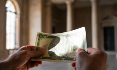
NEWS
Planet Labs Halts Satellite Imagery of Iran War Zone Indefinitely
Planet Labs, one of the world’s largest commercial satellite imaging companies, announced on April 5, 2026, that it will indefinitely stop sharing pictures of Iran and the broader Middle East conflict zone. The California-based firm made the decision in an email to customers, saying the U.S. government had asked all satellite imagery providers to indefinitely withhold imagery of the conflict region.1 The move has sent shockwaves through newsrooms, aid groups, and open-source researchers who depend on these daily images to track what is really happening on the ground.
What Exactly Is Planet Labs Blocking?
The restriction is retroactive to March 9, 2026, and replaces a previous 14-day delay policy with a more restrictive “managed access” model. Under this new framework, Planet Labs will withhold high-resolution SkySat and medium-resolution PlanetScope data from its public-facing platforms.2
This is not a temporary slowdown. It is an open-ended blackout with no set end date.
Planet Labs said in its email to customers that it would switch to a “managed distribution of images” that it deemed not to pose a safety risk. Under a new system, Planet Labs will release imagery on a case-by-case basis for urgent, mission-critical requirements or in the public interest.1
The escalation happened in stages. The restriction expands upon a 14-day delay on imagery of the Middle East that Planet Labs implemented last month, which extended an initial 96-hour delay.3 So the company went from a four-day pause, to a two-week hold, to a full and indefinite freeze in roughly one month.
Here is a quick look at how restrictions have tightened:
| Timeline | Restriction Level |
|---|---|
| Early March 2026 | 96-hour delay on Middle East imagery |
| Mid-March 2026 | Extended to 14-day delay |
| April 5, 2026 | Indefinite blackout, retroactive to March 9 |

Planet Labs satellite imagery blackout Middle East conflict zone 2026
Why the U.S. Government Asked for the Blackout
This policy shift follows a direct request from the United States government, specifically the administration’s national security team, to prevent commercial data from being leveraged for “tactical advantage” by adversarial actors.2
The war began when the U.S. and Israel attacked Iran on Feb. 28, and the conflict spread in the region when Tehran responded by launching its own attacks on Israel and U.S. bases in Gulf states, including Saudi Arabia, Kuwait and Bahrain.4 Some space specialists say Iran could be accessing commercial imagery, including pictures obtained via U.S. adversaries.4
Washington’s core fear is straightforward. The U.S. government’s move aims to prevent “adversarial” use of commercial data for target identification, weapons guidance, or missile tracking, capabilities that have become increasingly accessible to non-state actors and foreign militaries via private-sector providers.5
The move comes as President Donald Trump ramps up pressure on Tehran with a 48-hour ultimatum tied to keeping the Strait of Hormuz open, a chokepoint that carries about one-fifth of global oil and liquefied natural gas flows.6
“These are extraordinary circumstances, and we are doing all we can to balance the needs of all our stakeholders.” ~ Planet Labs, in an email to customers
This Is Not the First Wartime Imagery Blackout
The concept behind Planet Labs’ decision is known in the space industry as “shutter control.” This move represents a modernized application of “shutter control,” a regulatory power that allows the U.S. government to restrict commercial remote sensing during periods of heightened geopolitical tension.2
The U.S. government used a different but equally effective approach after the September 11 attacks. During the early stages of the war in Afghanistan in 2001, the Pentagon avoided a potential First Amendment showdown over shutter control by utilizing a “buy-to-deny” strategy. The National Imagery and Mapping Agency spent millions of dollars to purchase exclusive rights to all high-resolution imagery of the conflict zone from private providers. By becoming the sole customer, the government effectively created a commercial blackout.2
Back then, there was only one major commercial satellite provider. Today, the landscape is far more crowded, which makes the current “voluntary” approach the practical choice. Under the Land Remote Sensing Policy Act of 1992, any U.S. company wishing to operate a private remote sensing system must obtain a license. This license is not a broad grant of free speech but a conditional commercial permit. By accepting the license, companies like Planet Labs or Maxar formally agree to comply with “shutter control” provisions.2
The legal framework means the government does not need a court order. The power sits inside the license itself.
Who Loses When the Satellites Go Dark
The biggest losers are the people and organizations who rely on affordable, frequent satellite pictures to hold power accountable.
- The decision has created an immediate data void for journalists, human rights monitors, and open-source intelligence (OSINT) analysts.2
- Washington Post reporter Evan Hill suggested the announcement would limit reporters’ access to information from “one of the most important US-based commercial satellite imagery providers on whom most media outlets rely.”7
- Satellite imagery has been crucial for verifying losses among U.S. air defense and aviation assets, according to the international OSINT community.8
CBS News used Planet Labs imagery to demonstrate that a February 28 strike near a girls’ school in Minab, Iran, also destroyed structures within the compound of a nearby Iranian military base. That kind of analysis is precisely the capability the blackout eliminates. And it cuts both ways: it prevents adversaries from tracking U.S. and allied military positions, but it also prevents the public from independently evaluating the government’s claims about strike accuracy, civilian casualties, and operational progress.9
Industry analysts note that while Planet Labs is the first to explicitly cite a government request, other major providers are following suit. Vantor (formerly Maxar) and BlackSky have also implemented tighter controls or delays on Middle East imagery.2
Without independent verification, misinformation travels faster and fact-checking slows to a crawl.
Where Analysts Are Turning for Alternatives
The OSINT community is not sitting idle. European Space Agency (ESA) Sentinel data remains a primary alternative, though its lower resolution is less effective for detailed battle damage assessment. Researchers are also reportedly exploring access to international commercial providers based in jurisdictions outside U.S. “shutter control” reach, such as specialized Synthetic Aperture Radar (SAR) firms and certain Asian imaging constellations.2
But none of these options match what Planet Labs offers. ESA’s Sentinel constellation provides free, publicly available imagery, but at 10-meter resolution it’s too coarse for the kind of detailed battle damage assessment that requires distinguishing between a damaged building and an intact one next door.9
For investors, the picture looks different. Planet Labs shares last closed at $35.02, with the stock up 25.6% over the past week, 38.5% over the past month, and 71.6% year to date.10 Investors seem unbothered. Planet’s stock rose more than 16% in the days surrounding the blackout announcement, likely driven by the perception that government reliance on commercial imagery firms will deepen as the conflict continues.9
The tension is real. A company built by former NASA scientists to democratize access to Earth imagery is now restricting that very access at the government’s request. Planet Labs has not specified what criteria will govern imagery releases under the managed distribution model or when it expects to resume standard distribution.11
As the war in the Middle East deepens, so does this information blackout. Planet Labs said access to imagery outside the designated region remains unaffected and noted that it will continue to review the policy as the situation evolves.12 But for the millions of people caught in the crossfire and the journalists trying to tell their stories, a blank screen is a dangerous thing. When we cannot see what is happening, we cannot hold anyone accountable. That should concern all of us, no matter where we stand on this conflict.
Share your thoughts in the comments below. This topic is generating massive discussion online, so join the conversation using #PlanetLabsBlackout on X and share this story with anyone who cares about press freedom and transparency in times of war.

Howard the Duck at 40 Still Owns Marvel’s First Flop

Valve Skin Ban Hits BLAST and Forces CS2 Teams Toward Betting Cash

Oil Crashes Below $80 as Iran Talks Restart and Markets Split

Netflix Screening Erases Fortitude Exclusivity in $105M Cage Suit

Bitget BGBTC Upgrade Turns Idle Bitcoin Into Daily Yield

FFXIV Switch 2 Port Brings Portability With a Second Bill

MacBook Air Delays Reveal AI Memory Crunch Repricing Laptops

Bitcoin BIP-110 Soft Fork Dies on Tiny Miner Support

CXMT LPDDR6 Push Locks In Mobile DRAM Split

Snapchat Hands Spotlight Priority to Human Creators Over AI Farms

Kalshi Loses Major NY Prediction Markets Ruling to Judge Torres

Fed Minutes Cite AI Demand as Inflation Risk, Put a 2026 Hike Back on the Map

Marker AI Writing Startup Lands $13M Seed Led by Index Ventures

Dota 2 Esports World Cup 2026: Spirit Defends $2M Title In Paris

Meta’s Muse Spark 1.1 Beats Rivals on Price, Trails on Coding

ARC Intelligence Closes €4M Seed Round in Roughly a Week

CS2 Premier Season 5 Lands With Cache and a C4 Damage Rework

Finto Picks Munich Over Silicon Valley After YC, Raises $3.4M

Backrooms Returns to Theaters as the Everything Must Go Edition

Trump Calls Iran ‘Islamic Republic of Japan’ as Ceasefire Ends
-
 FINANCE2 months ago
Zcash Patched a Double-Spend Bug as ZEC Climbed 5%
-
 ENTERTAINMENT2 months ago
Steam Summer Sale 2026 Locks In June 25 to July 9 Dates
-
 FINANCE1 month ago
CLARITY Act Final Text Expected This Weekend as 60-Vote Hurdle Looms
-
 NEWS3 months ago
Meta Adds AI Replies to Threads, But Users Can’t Block It
-
 ENTERTAINMENT3 months ago
‘Widow’s Bay’ Review: Apple TV’s Sleeper Horror-Comedy Earns Its Fog
-
 NEWS5 months ago
U.S. Navy Deploys Solar-Powered Lightfish Drone to Patrol Oceans
-
 NEWS8 months ago
FolderFresh Review: This Free Tool Automates Windows File Organizing
-
 FINANCE4 weeks ago
Kalshi Loses Major NY Prediction Markets Ruling to Judge Torres